


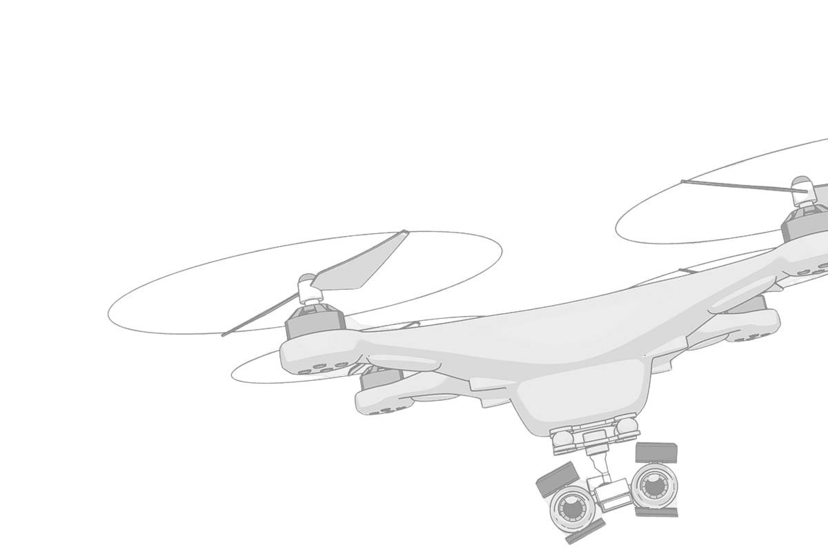
Applications
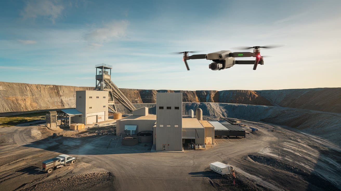 ,
,Mining & Geology
Comprehensive mapping and surveying of topography for both brownfield and greenfield open-cast quarry/mining projects.
 ,
,Steel Industry
Our specialized drone solutions provide precise aerial data, helping you streamline exploration
 ,
,Renewable Energy
Real time inspection and monitoring of wind turbine blade, solar farm, detection of defects and AI enabled analysis to enhance performance and operational efficiency.
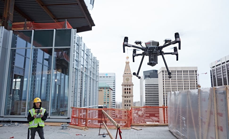 ,
,Civil Infrastructure
Improving efficiency, safety, and precision in civil construction projects.
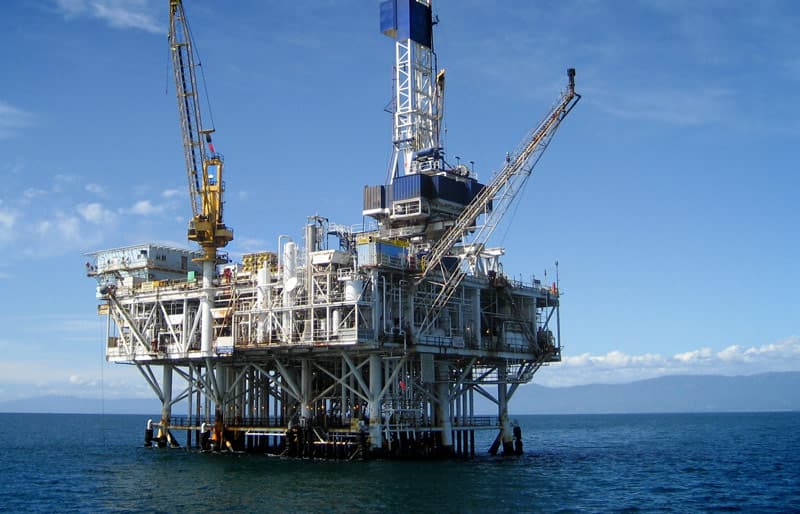 ,
,Oil and Gas
Efficient HSE Management vis-à-vis cost optimization during scheduled inspection of the assets and monitoring of exploration and production facilities.
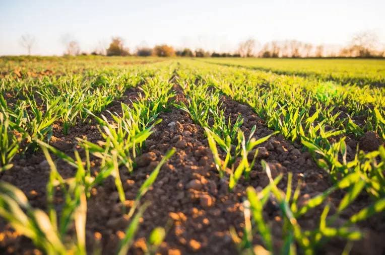 ,
,Agriculture & Livestock
Advanced data collection and analysis for crop health, soil conditions and yield optimization.

OUR EXPERTISE
Cultivating Excellence: Our Areas of Mastery
DELIVERING PROJECTS SUCCESSFULLY
Our expertise spans Agriculture, Energy, Mining, and Infrastructure, along with successful projects in Marine Conservation and Environmental Monitoring of offshore and onshore fields.
IN-DEPTH UAV MARKET KNOWLEDGE
Our team is highly attuned to the UAE government's UAV policies, leveraging this expertise to navigate and lead the evolving UAV market in collaboration with research labs and institutes.
OUTSTANDING TEAM OF PROFESSIONALS
We combine decades of academic research experience with operational expertise, ensuring that our end-to-end solutions are both innovative and effectively executed in real-world applications.
Would you like to collaborate with us?
Get in touch with us now to initiate a collaborative project.
How we do it
Compared to conventional survey methods, aerial 3D mapping with drones is faster, more convenient, cost-effective, and highly accurate in geo-referencing. Large areas—up to 5 sq. km—can be mapped in a day, with data processing completed in about five working days.
Preparation
To fully understand project requirements, the Vista Drone (VD) team conducts a reconnaissance of the site before initiating preparations for data acquisition.
ground control points
We use a high-accuracy GPS system to establish visual ground control points, ensuring precise geo-referencing and survey-grade data quality.
flight planning
Our survey flight plans are carefully designed to capture UAV data with precision, specifying flight direction, resolution, flight path, and stereo overlap to ensure optimal coverage and data quality.
data acquisition
After uploading the survey schedule, data acquisition is fully automated. The drone follows pre-programmed waypoints to systematically collect high-precision data.
post flight data processing
After the flight, we verify the data quality on-site. Once it meets our standards, we proceed with detailed data processing at our data lab.
final product
Our software generates CAD-ready ortho-photos, contours, DSM/DTM models, point clouds, and 3D models, fully compatible with CAD and GIS platforms.
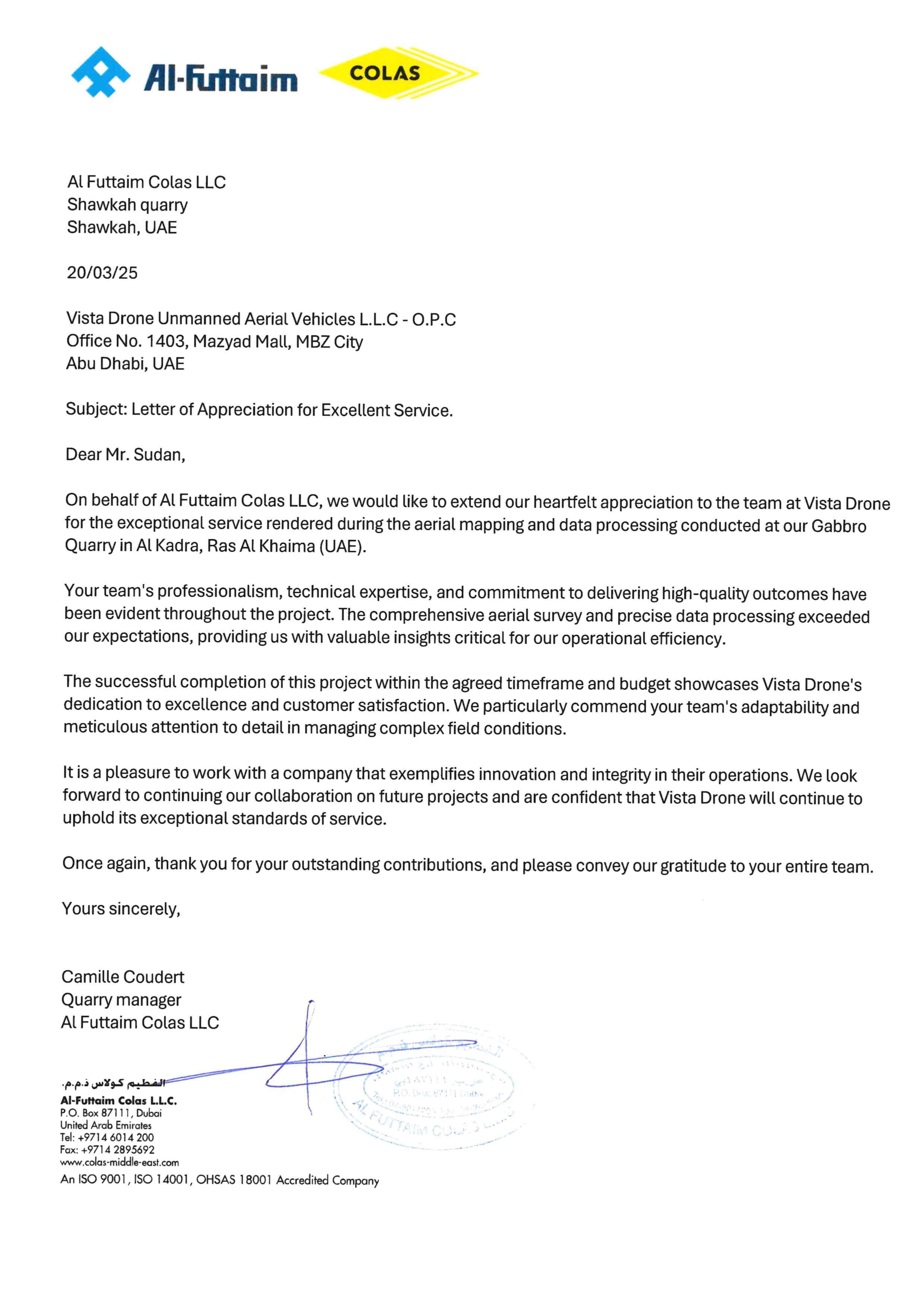
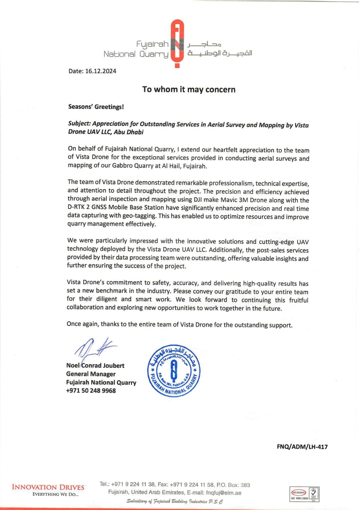
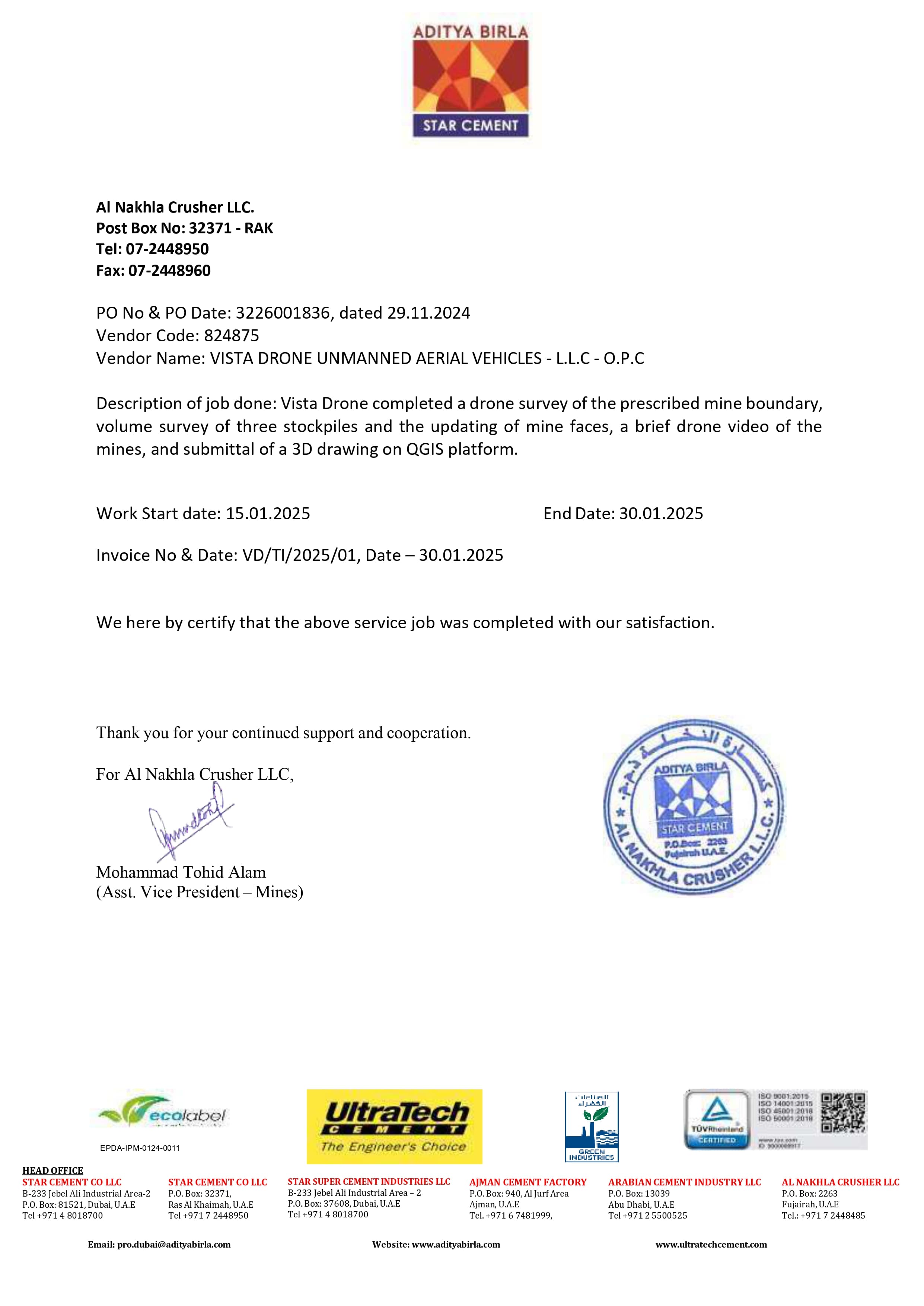
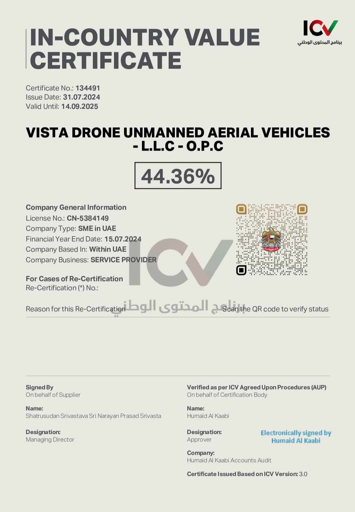
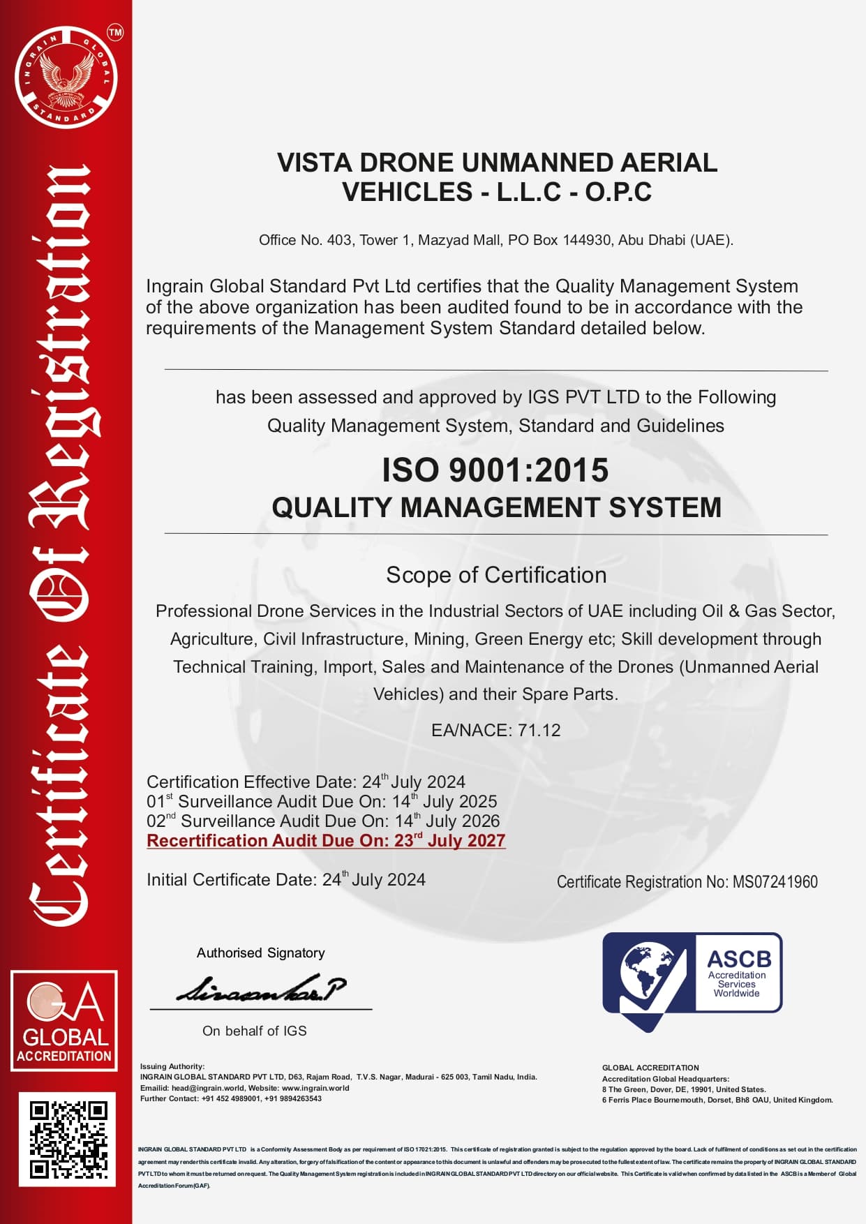
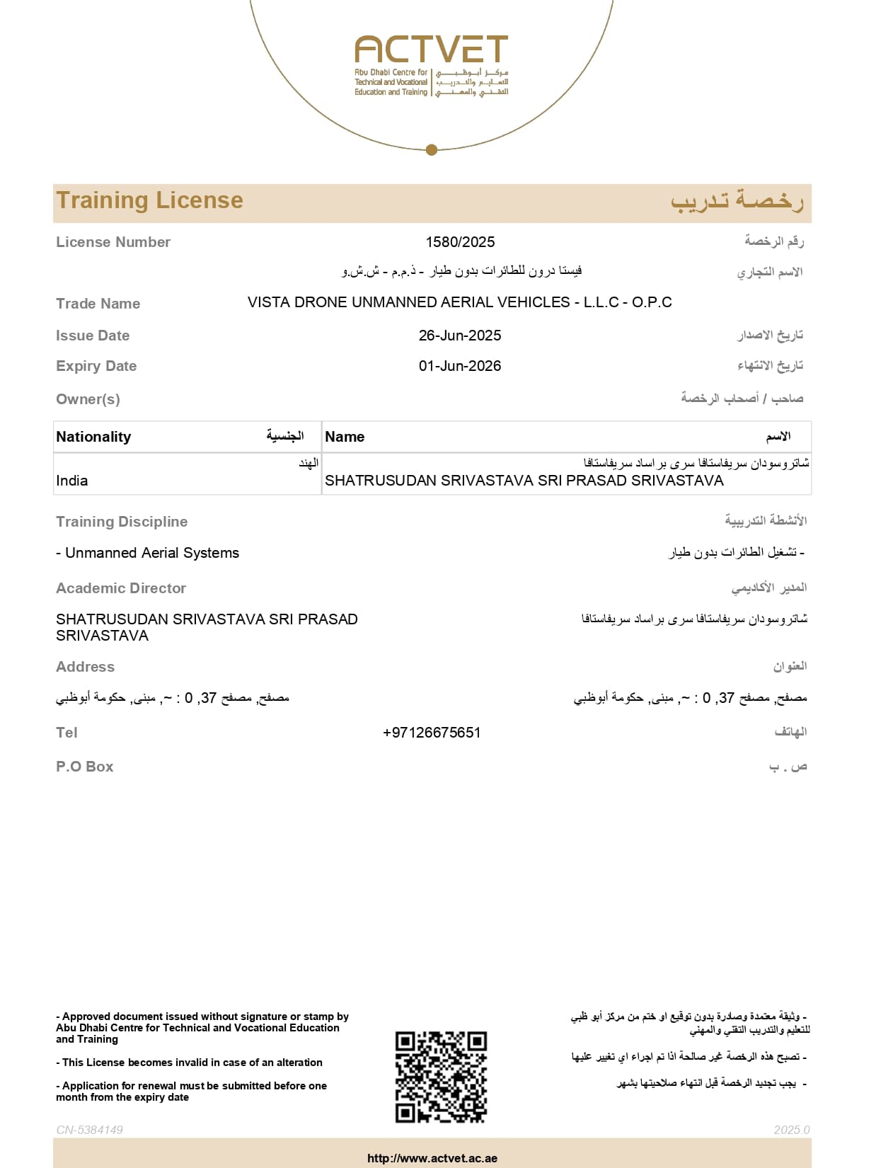
RECOGNITIONS, CERTIFICATIONS & ACCREDITATIONS